
Tracking down tropical cyclones
Although cyclone seasons are well-known, being able to predict precisely where and how severely these storms are likely to affect a particular location is much harder to calculate.
Cyclones are erratic weather phenomena, and the historical data available is often not detailed enough to be able to base future predictions on. This is especially true in parts of the world where the record-keeping of tropical storms is relatively recent. But what if you could access information on thousands of years of cyclones?
A tropical cyclone is an intense circular storm that originates over warm tropical oceans and is fuelled by water with a temperature above 26.5°C. The characteristic and damaging features of tropical storms, are low atmospheric pressure with high winds and heavy rain, resulting in large waves and destructive surges at coasts. But the effects can be very localised, and only specific cyclone tracks cause a significant surge, and calculating wind fields is crucial to accurately predict the resulting waves.
Now HR Wallingford marine scientists have developed a method to expand the amount of data available for specific sites. This means they will be able to model likely future cyclone events more precisely.
Dr Stephen Grey, Principal Marine Scientist in the Coasts and Oceans Group at HR Wallingford, said: “Having identified sources of historical cyclone track data, we set out to develop tools to extract, analyse and quality control this data. We then investigated methods to simulate cyclone wind fields, and to investigate and validate the modelling of the surge and waves caused by cyclones.”
Dr Ye Liu, Principal Statistician in HR Wallingford’s Flood and Water Management Group, explained: “One of the main challenges we face when modelling cyclone prediction is a lack of data because the historic cyclone tracks for which data are available are often too few. We needed to devise a method to create synthetic cyclone tracks to increase the number of events from which to predict extreme conditions. Crucially, the simulated tracks had to be realistic and statistically valid, but they also needed to include rare but possible events like Cyclone Gonu which occurred in the Gulf of Oman and headed towards Iran, where these types of storm are virtually unheard of.”
The scientists hope that the new modelling tool will improve the assessment of the risk of cyclones at specific locations. This can then be used to support the design of coastal infrastructure such as seawalls and breakwaters, and help to avoid the danger of either under or over-design which can be equally risky and costly.”
More in Business Parks
HR consultant moves office from garden studio to Howbery Park’s Manor...
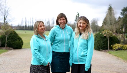
Jane Fryatt, who set up her own HR consultancy in 2018 in her garden studio, has moved to offices in the Manor House at Howbery Business Park. Jane has been coming to Howbery Park since 2012 as all of her children have been to Puddleduck Nursery. After setting up her own business at home six […]
Howbery Business Park hosts forest school activities in enchanting woodland clearing
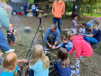
A woodland clearing in the beautiful grounds of Howbery Business Park near Wallingford has been transformed into an enchanting space for children to play and learn in the great outdoors. Wild Wood Warriors Forest School, Puddleduck Nursery and Howbery’s grounds team have worked together to create an area where young minds can appreciate the wonders […]
Howbery Park helps hedgehogs
Howbery Business Park has been focusing on improving support for hedgehogs in its grounds for a year, as part of a six-year biodiversity programme. The team has added hedgehog houses, worked on improving food supplies and checked there are corridors through the park for the prickly creatures to move. In recognition of meeting criteria set […]
From this author
HR consultant moves office from garden studio to Howbery Park’s Manor...
Jane Fryatt, who set up her own HR consultancy in 2018 in her garden studio, has moved to offices in the Manor House at Howbery Business Park. Jane has been coming to Howbery Park since 2012 as all of her children have been to Puddleduck Nursery. After setting up her own business at home six […]
Howbery Business Park hosts forest school activities in enchanting woodland clearing
A woodland clearing in the beautiful grounds of Howbery Business Park near Wallingford has been transformed into an enchanting space for children to play and learn in the great outdoors. Wild Wood Warriors Forest School, Puddleduck Nursery and Howbery’s grounds team have worked together to create an area where young minds can appreciate the wonders […]
Howbery Park helps hedgehogs
Howbery Business Park has been focusing on improving support for hedgehogs in its grounds for a year, as part of a six-year biodiversity programme. The team has added hedgehog houses, worked on improving food supplies and checked there are corridors through the park for the prickly creatures to move. In recognition of meeting criteria set […]